UAS Aerial Solutions specialize in photogrammetry 3D mapping. Our drone (UAV) pilots are industry experienced in land surveying and construction.
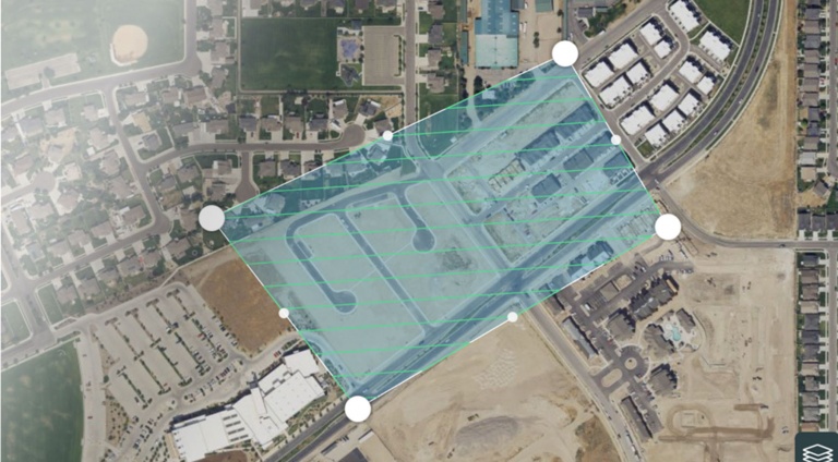
To improve the detail of our 3D mapping we take oblique aerial images at 30° and 45 ° angles flying around objects at different altitudes, in addition to flying the normal overlapping lawnmower path regular grid pattern. As all the images are geo-referenced, these additional oblique images add depth and detail to the final 3D rendered model when the images are draped over the wire frame mesh.
The 3D textured wire framed mesh is a representation of the shape of the model that consists of vertices, edges and faces together with the texture which is projected to it.
This sparse and dense point cloud is triangulated to create a wire frame mesh model which can be saved as a file and imported into most GIS, CAD compatible software for further analysis.